
Winding its way from thick lodgepole forests to high alpine meadows, and down through plunging canyons to the edge of Montana ranch country, the Beaten Path is one of the most iconic Montana trails outside Glacier National Park.
Located a stone’s through from Yellowstone in the Beartooth Mountains, the Beaten Path is a point-to-point trail running from the Clark’s Fork Picnic Area outside of Cooke City to the East Rosebud Trailhead in the community of Alpine.
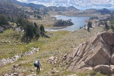
Used as a jumping-off point for alpine adventures in the Absorka-Beartooth Wilderness, the Beaten Path is a great way to quickly access the high country the area is known for. The trail is wide, well-traveled, and typically well-maintained.
While sections can become muddy from horse traffic, the trail is typically in great shape during the summer and early fall months. Huckleberries line the path in season and it’s not uncommon to see bears and moose along the way.
The Beartooth Mountains receive the most snow of any mountain range in Montana, meaning that the season for this trail is later than those found in lower-elevation ranges.
Mosquitos can be prolific in the spring and early summer and it’s not uncommon for it to snow in the high country at any time of year. Despite these challenges, the Beaten Path is a beautiful excursion into one of the most wild and remote corners of the Mountain West.
This is an awesome adventure and is one of the dozens of backpacking trip guides we put together based on our wilderness trips.
Quick Facts
- Distance: ~27 miles
- Days Needed: 2-3
- Type of Trail: Point to Point
- Elevation Gain: ~3,500’
- Best Time to Travel: End of June to mid-September
- Permits: No permit required
- Difficulty: Moderate
Highlights
- Alpine scenery
- Well maintained trail
- Abundant lakes and waterfalls
- Opportunities to extend the trip
- Ample fishing opportunities
- Net elevation is downhill (southwest to northeast)
Lowlights
- Mosquitos
- Habituated mountain goats at certain campsites
- Short season
- Afternoon thunderstorms
- Challenging car shuttle
Best Time to Hike
The nearby town of Cooke City is the snowiest in Montana with an average snowfall of over two hundred inches. While this helps maintain some of the last glaciers in Southwest Montana, it makes the alpine hiking season short.
The best time to hike the Beaten Path is typically the end of June through mid-September. While the trail does not cross any steep passes, it does go up to 10,000 feet. After the snow recedes, the trail can become very wet and muddy which usually coincides with the first significant hatch of mosquitos. Hiking later in the summer ensures drier conditions. The first snow typically falls in September but the early fall can be the perfect time to hike with cooler temperatures and fewer visitors.
Difficulty of Trail
At approximately 27 miles in length, the Beaten Path is best suited for one to two nights. While many ultra-distance enthusiasts do hike and run it in a day, a slower pace may fit others better.
The trail is typically in good condition and is wide and well-traveled. Going up to an elevation of 10,000 feet, altitude may be a consideration if you know that you are susceptible.
Doing the trail from the Clark’s Fork side and ending at the East Rosebud side means that it has a net loss of elevation finishing lower than where you started. This makes for a great last day on the trail that is almost completely downhill.
We consider this to be a moderately challenging trail. While it is all on a well-traveled trail, its remoteness, possibility for wildlife encounters, and altitude make it slightly more challenging than trails in less remote locations.
Weather Conditions
At an altitude upwards of 10,000 feet, inclement weather is always a possibility. In the summer, intense afternoon thunderstorms build to unleash downpours and hail storms. We recommend coming prepared with solid rain gear and warm layers no matter the time of year. Know lightning protocol and be prepared to squat out a storm if need be. Wildfires are also a consideration later in the summer. Adhere to all burn bans and rules on campfires.
Wildlife
The Beaten Path traverses a remote section of the Beartooth Mountains of Southwest Montana, making it a corridor for large animals like grizzly bears and moose. We suggest hiking with bear spray and keeping all food in a bear-proof container or hanging it at camp. Many campsites along the trail come with established bear hang poles.
Many of the higher altitude campsites also come with mountain goats that will approach (and eat) your food if it’s not properly stored. They also seek out human pee spots to lick up the salt (and incidentally, also enjoy licking trekking pole grips). They are generally docile but it’s best to avoid habituating these animals to humans more than they already are.
Terrain
The rolling terrain on a well-traveled trail makes it suitable for most hikers. However, it is still important to be prepared in case of an emergency, especially in a remote spot such as this. Carry a first aid kit and a personal locator beacon (PLB) and know how to use both. As in most backcountry emergencies, the most reliable evacuation is a self-evacuation. It may take a long time for help to arrive.
Planning Your Trip & How to Get There
The Beaten Path is located in one of the more remote corners of the country. The nearest large airport is in Billings, MT (BIL) three hours from the start. Renting a car is wise as there is no public transportation to either trailhead.
The town of Red Lodge is considered the base camp of much of the Beartooth Range and has all the amenities needed for gearing up for a backcountry excursion. There are no permits needed for this trail. The Clarks Fork trailhead is located within the Gardiner Ranger District and the East Rosebud end is located within the Beartooth Ranger District. Call either for trail conditions.
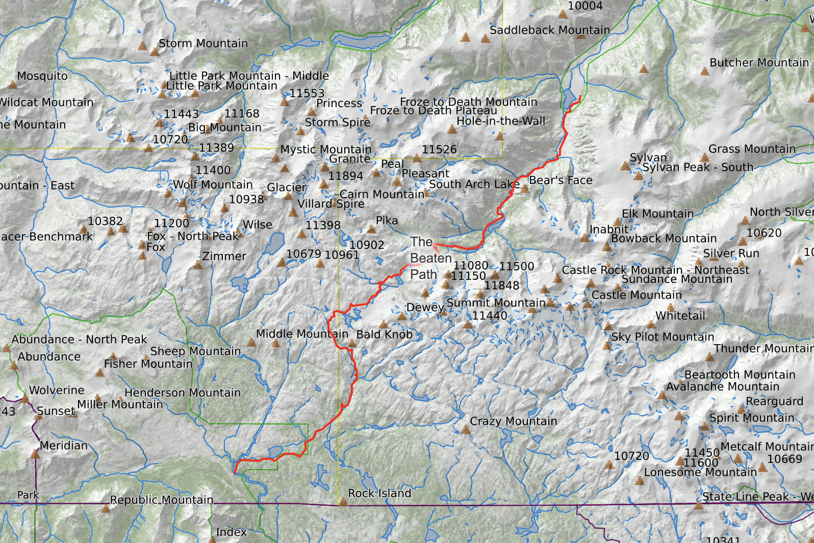
The Beaten Path Route
The Beaten Path is a point-to-point hike with trailheads at the Clarks Fork Picnic Area outside of Cooke City and the East Rosebud Trailhead near Alpine. While the East Rosebud side has the more dramatic scenery, the Cooke City side starts at a substantially higher elevation. By starting at that side, you can enjoy a net downhill hike down to East Rosebud.
Distances between destinations are immense in Montana and this is no exception – there is a ninety-five-mile car shuttle over Beartooth Pass and around the mountains. Many parties find someone to trade car keys with or figure out a car shuttle option well in advance. Both trailheads are remote with no cell service, so planning ahead is key.
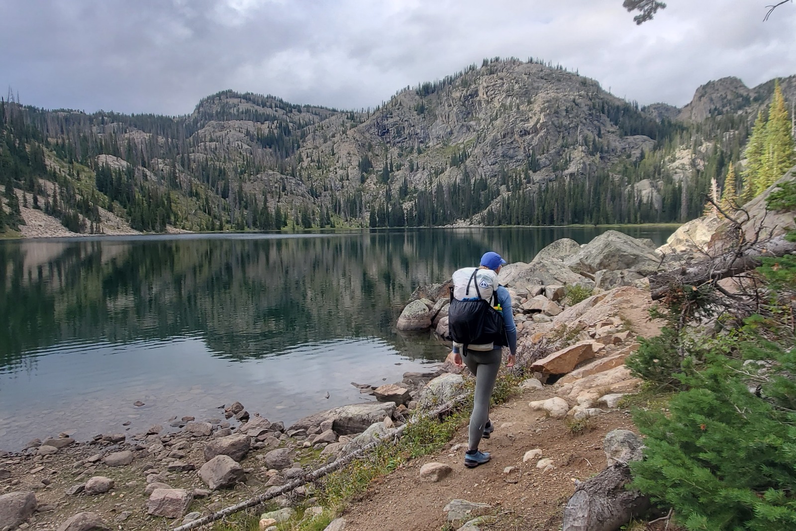
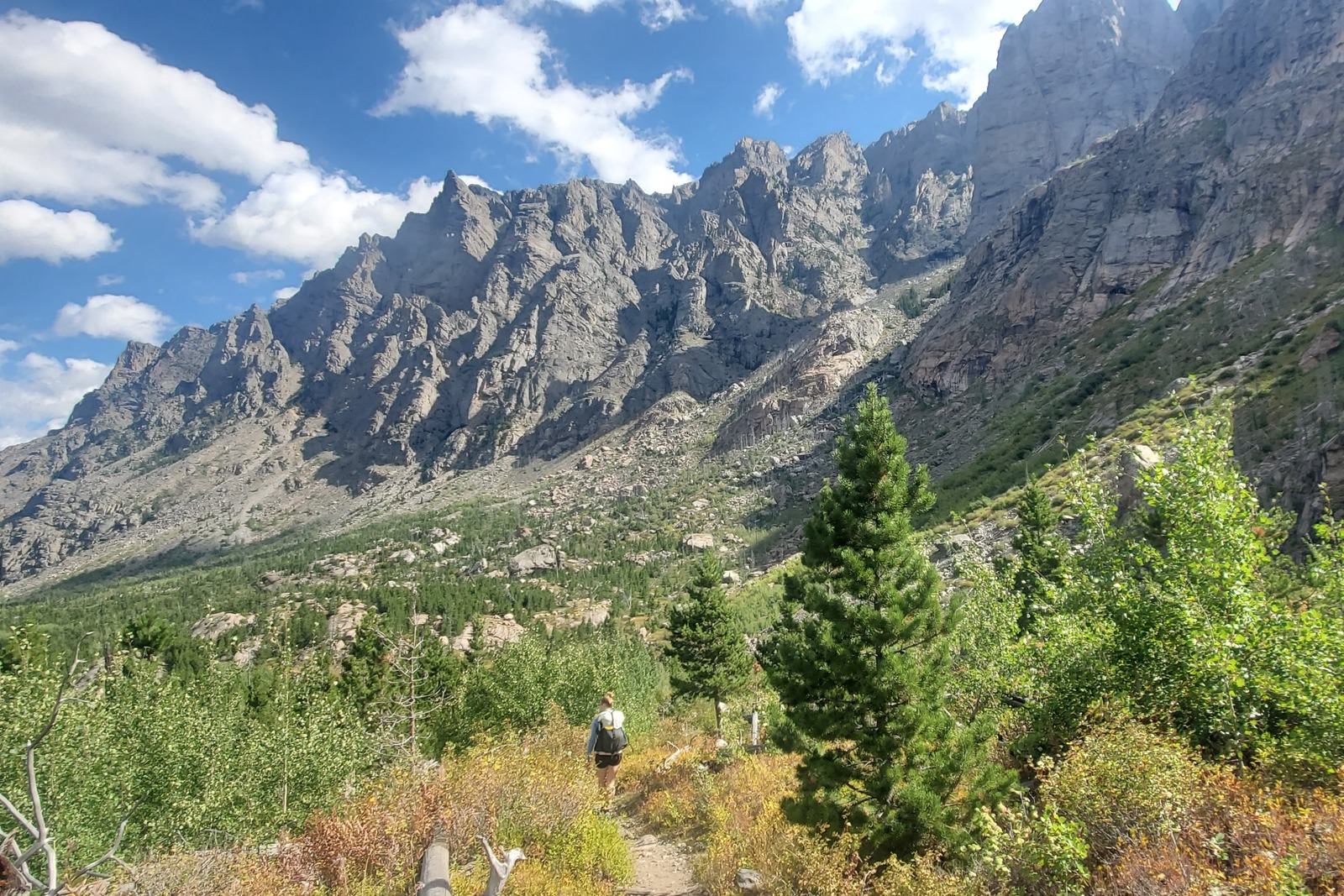
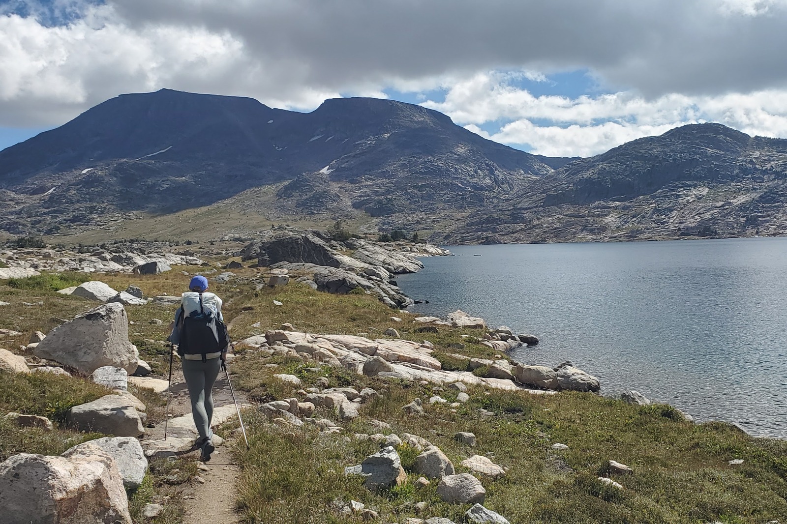
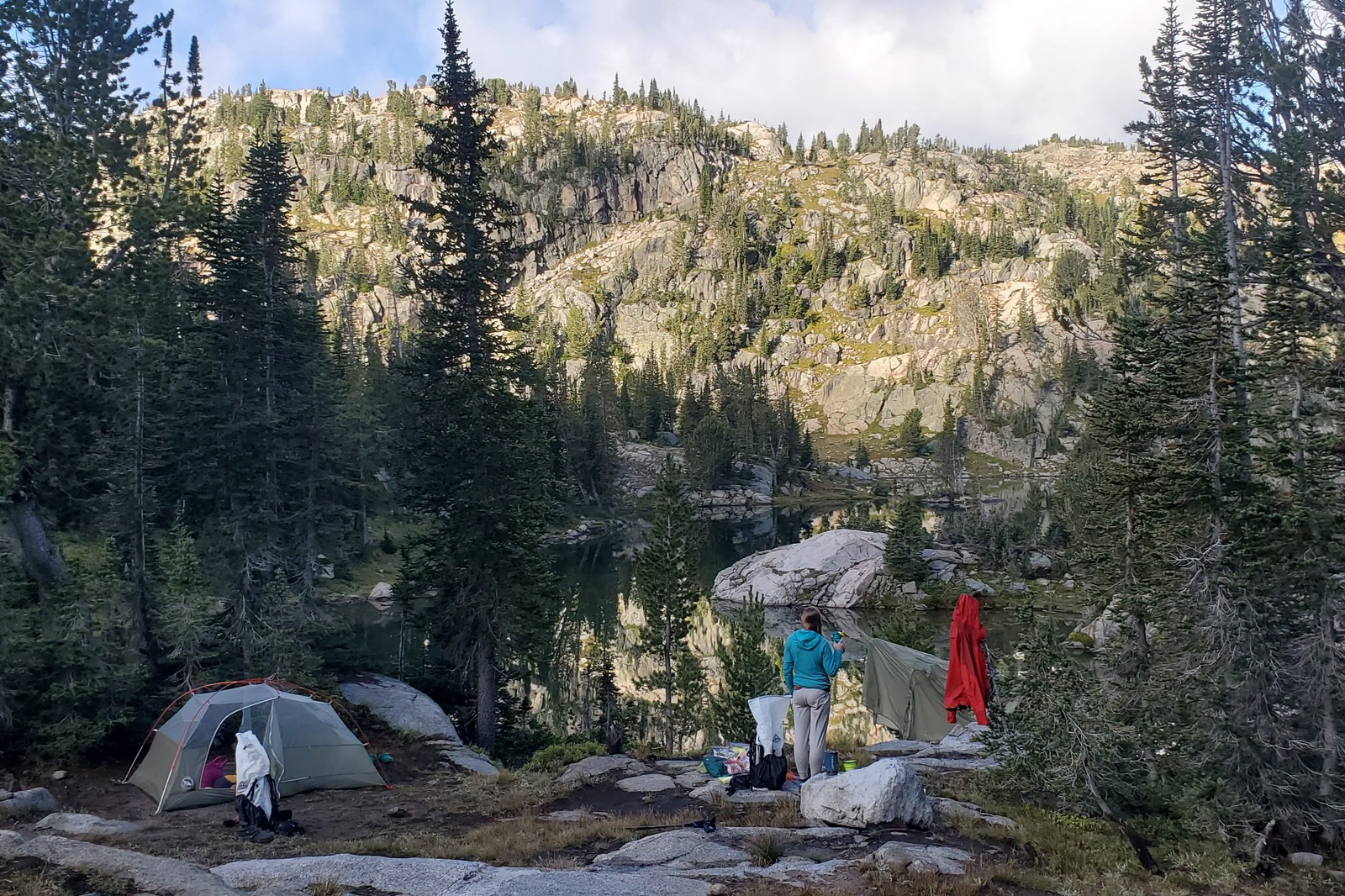
Starting from the Clark Fork Picnic Area, take the Russell Creek Trail. It crosses the beautiful Clarks Fork of the Yellowstone River immediately after leaving the parking lot. The trail winds through the dense Lodgepole Pine forest for the next six miles. This section of trail is frequented by horses, so expect it to be muddy. Huckleberries are plentiful along this section of the trail. At about 8 miles around Ouzel Lake, the path starts to open up with an excellent campsite along the lake.
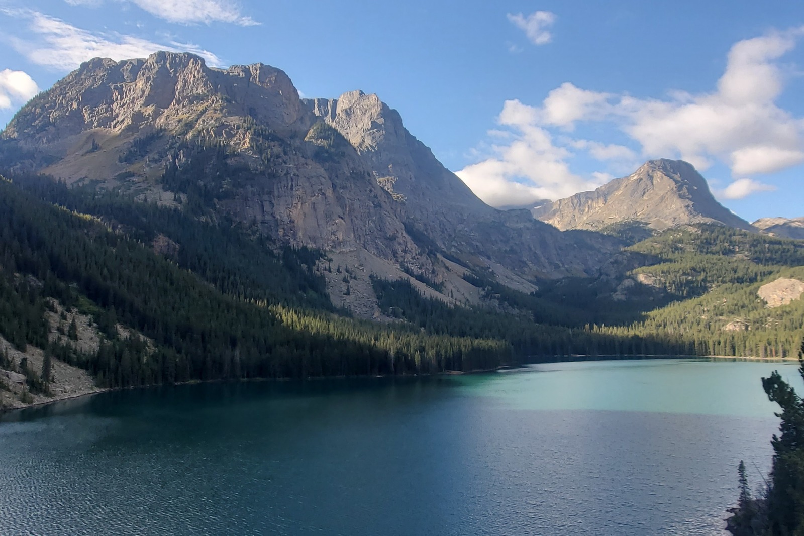
The next section reaches the highest point near Fossil Lake. Here you are greeted with expansive views of the Beartooth Plateau and some of the highest mountains in the state. The walking here is smooth and easy with lots of opportunities to explore the alpine. A myriad of lakes and creeks filled with cutthroat trout glitter around every corner of this beautiful section. You are allowed to camp around Fossil Lake, but fires are not permitted in this sensitive alpine environment.
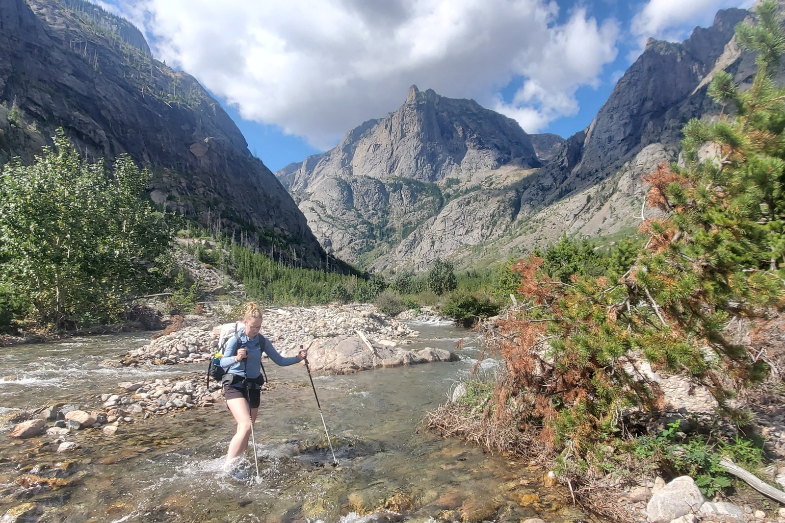
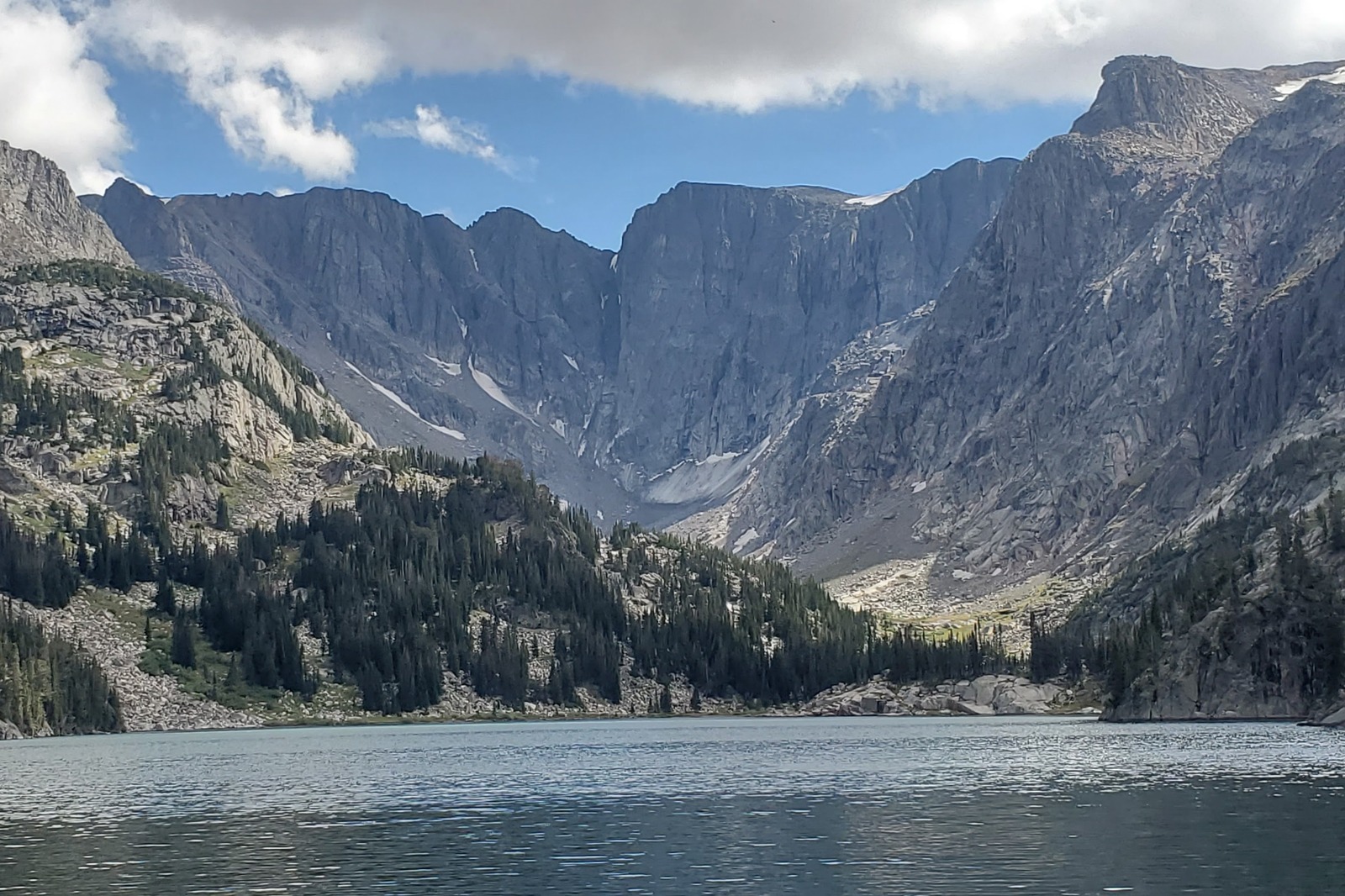
After passing Fossil Lake, you start the long downward journey following East Rosebud Creek as it tumbles and cascades out of the mountains. Beautiful waterfalls and cascades line the trail as it winds its way down. Some sections include incredible shelves and trail construction as it meanders along ledges and cliffs above beautiful waterfalls. Now below treeline, huckleberries and campsites are abundant.
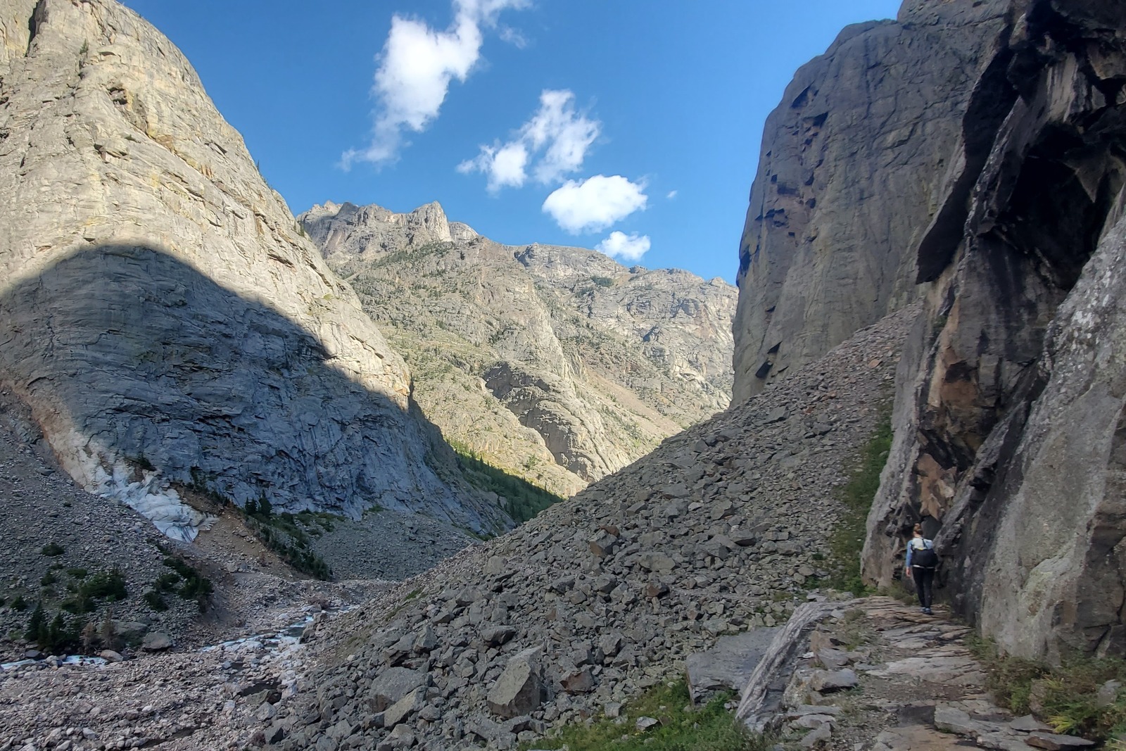
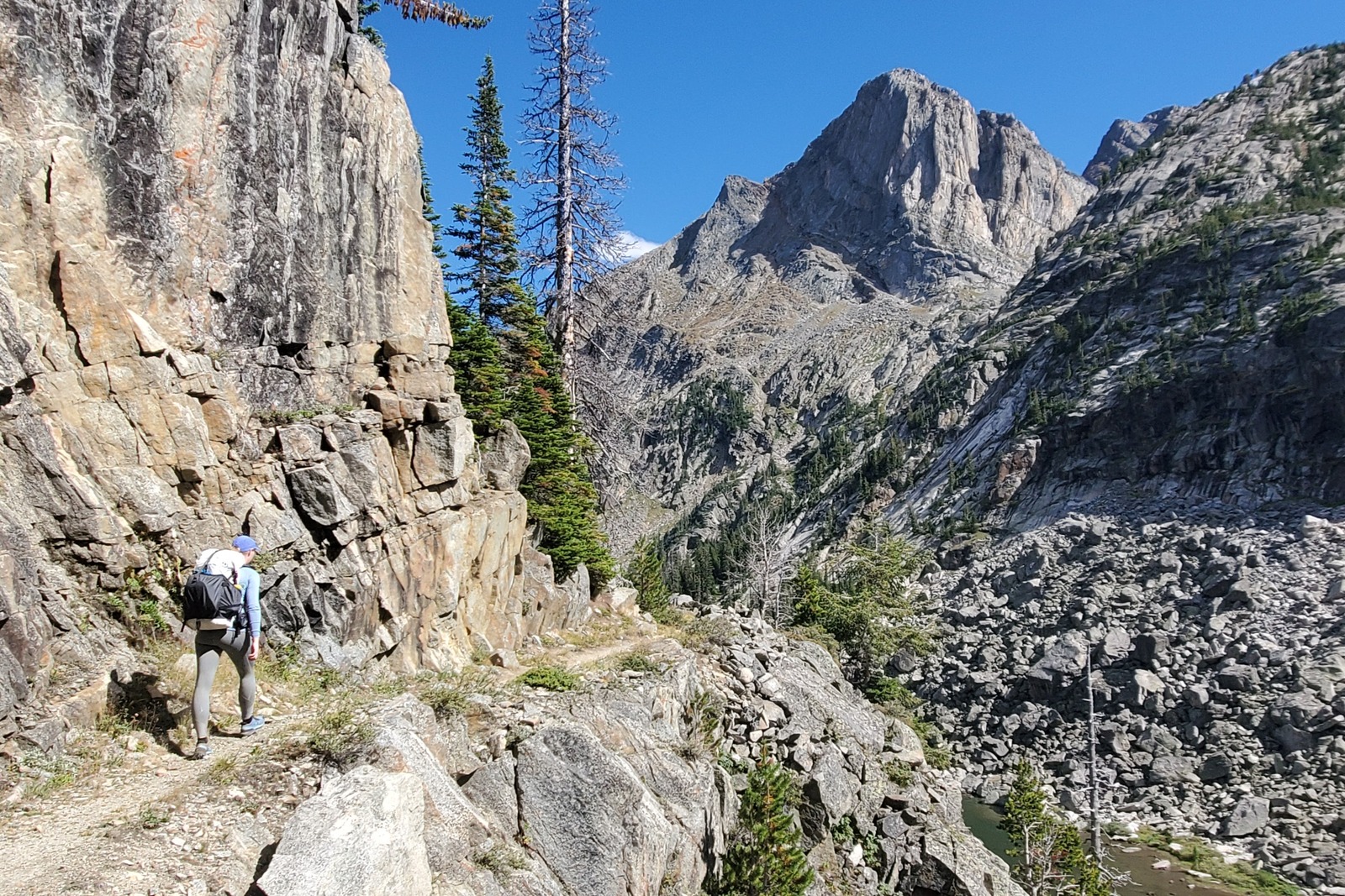
Now on the East Rosebud Trail, the Beaten Path starts to change in character. The trail becomes rockier and the walls of the canyon soar above as the creek carves its way through the canyon. After passing Rimrock Lake, the trail descends through the soaring granite walls of the East Rosebud Canyon. This impressive canyon was heavily flooded in June 2022 (as was the rest of the Yellowstone Region). After passing Elk Lake, the river has eroded the trail in parts requiring side-hilling through dense lodgepole forests and over boulders in spots to avoid the river. At times, the easiest way is walking down the river, water levels permitting.
The final few miles of the trail pass through thick lodgepole forests of identically aged trees that grew after the 1996 Shepard Mountain fire. In hot temperatures, this section can be exposed to the sun, but is not long to go before the trailhead at East Rosebud Lake. Finish your hike with a burger and beer down in the small town of Roscoe at the Grizzly Bar.
Backpacking Gear – What to Pack
Gear List
Make sure to check out our Ultimate Backpacking Checklist so you don’t forget something important.
Below you’ll find our current favorite backpacking gear. If you want to see additional options, our curated gear guides are the result of many years of extensive research and hands-on testing by our team of outdoor experts.
BACKPACK
Conclusion
The Beaten Path is a beautiful trail that passes through some of the most remote and rugged corners of the country. Located near Yellowstone National Park, its quiet remoteness stands at odds with the crowds found within the park. This is a great trail for someone wanting to gain experience in a remote setting while still being on a well-established trail. Best done mid-summer to early fall, the Beaten Path delivers iconic Montana mountainscapes, plentiful swimming and fishing holes, and wonderful wilderness seclusion.
For even more info, take a look at our other popular content:


